
When farm challenges grow, smart tools need to grow with them.
Updated
January 8, 2026 6:32 PM
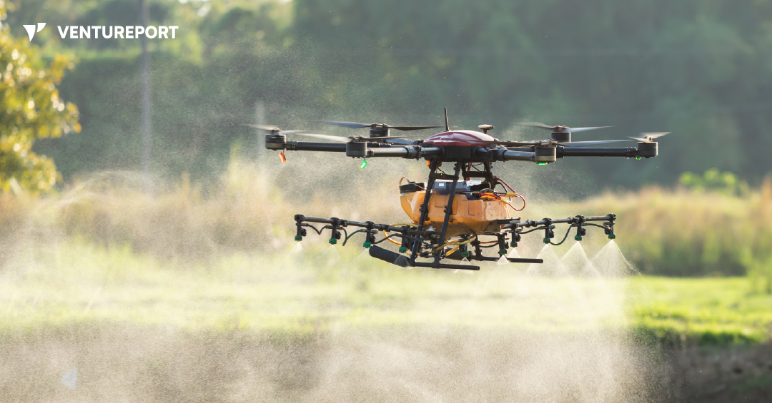
A drone spraying water over an agricultural field. PHOTO: FREEPIK
Farms today are under pressure. Fields are getting bigger, workers are harder to find and many jobs still rely on long hours of manual labor. XAG’s new P150 Max agricultural drone is designed for exactly this reality. Instead of replacing farmers, it takes over the heavy, repetitive fieldwork that slows them down, making farm operations more efficient and more precise.
The P150 Max is built around one simple idea: a single machine that can handle multiple farming tasks. Most farm drones focus only on spraying or mapping, but this one is fully modular. With a quick switch of attachments, it can spray crops, spread seeds or fertilizer, map fields or transport supplies. This flexibility helps farmers keep up with changing tasks throughout the day without needing different machines, improving both productivity and cost-efficiency.
A key challenge in agriculture is that fields are rarely smooth or predictable. Tractors can get stuck, smaller drones can’t carry much and some areas—like orchards or hilly plots—are simply hard to reach. The P150 Max fills that gap with an 80-kilogram payload and fast flight speed, letting it cover more ground per trip. Fewer takeoffs mean less downtime and more work completed before weather or daylight cuts operations short.
When it’s time to spray, the drone uses a smart spraying system that allows farmers to adjust droplet size based on the crop’s needs. This matters because precise spraying reduces waste and improves targeting. With an output of up to 46 liters per minute, the drone can serve both large open fields and dense orchards where consistent coverage is traditionally difficult.
The spreading system applies the same logic. Instead of dropping seeds or fertilizer unevenly, the vertical mechanism spreads material smoothly and resists wind drift. This ensures uniform application across irregular or hard-to-reach land—an ongoing challenge for modern farms aiming for higher yield and better resource use.
Another everyday issue for farmers is understanding and surveying the land before working on it. The P150 Max helps here with a built-in mapping tool that covers up to 20 hectares per flight and instantly converts the images into detailed maps. With AI detecting obstacles like trees or irrigation lines, the drone can plan safe and efficient autonomous routes, reducing manual planning time.
Beyond spraying and spreading, the drone can transport tools, produce and farm supplies using a sling attachment. This is particularly helpful after heavy rain, when vehicles cannot easily move across muddy or flooded fields.
Under all these functions is XAG’s upgraded flight control system, which provides centimeter-level accuracy even when network signals are weak. Integrated sensors—including 4D radar and a wide-angle camera—help the drone recognize hazards such as poles and wires. Farmers can manage all operations through the XAG One app or a handheld controller, both of which automatically generate the best route based on field shape and terrain.
Since long field days require long operating hours, the fast-charging battery system can recharge in about seven minutes using a dedicated kit. This supports continuous drone use throughout the day with minimal interruptions.
After years of testing, the XAG P150 Max is essentially an effort to make practical, scalable farm automation more accessible. By combining spraying, spreading, mapping and transport into one heavy-duty platform, it offers a way to ease labor shortages while keeping operations efficient and sustainable. Instead of focusing on one task, the drone aims to take over the time-consuming physical work so farmers can focus on decisions, planning and crop management.
Keep Reading
As industrial drone adoption grows, startups are finding bigger opportunities in infrastructure, inspections and field operations.
Updated
August 10, 2026 5:56 PM

An oil pump on a field. PHOTO: UNSPLASH
As drone adoption grows across industrial sectors, more startups are moving beyond hardware sales and into service-based business models. Instead of simply selling drones, companies are increasingly trying to build recurring revenue through inspection, mapping and infrastructure-monitoring services. That shift is shaping ZenaTech’s latest expansion strategy.
ZenaTech is a Vancouver-based startup that develops AI drone and Drone as a Service (DaaS) technologies. The company has signed an offer to acquire an Alberta-based land surveying and geomatics business operating across Western Canada. If completed, the deal would mark ZenaTech’s first land surveying acquisition in Canada and its first major push into the oil and gas sector.
The move gives the startup something more valuable than just another acquisition target. It provides direct access to an industry where drones are already becoming part of everyday operations.
The Alberta surveying company works with oil and gas producers across Alberta, Eastern British Columbia and Saskatchewan. Its services include land surveying, geomatics, mapping and environmental support for infrastructure and energy development projects.
According to ZenaTech, drones are already used in roughly 80 percent of the target company’s existing projects. That matters because it reduces the operational gap between traditional surveying work and AI-powered automation.
Rather than introducing drones into a completely manual workflow, ZenaTech is entering a business where drone-based data collection is already established. The startup says it plans to build on that foundation by integrating more AI-powered capabilities across surveying, mapping, inspections and infrastructure monitoring.
Shaun Passley, Ph.D., CEO of ZenaTech, said: "This proposed acquisition represents an important strategic expansion of our Drone as a Service business into Canada’s oil and gas sector, one of the most significant energy markets in North America. This company brings an established commercial customer base, strong regional expertise, and extensive experience supporting surveying and geomatics projects including for some large producers. We believe there is a significant opportunity to further enhance these services through AI-powered drone technology for surveying, mapping, inspections, and infrastructure monitoring applications, enabling us to establish a core expertise that we can bring to this fast-growing global industry."
The timing is also significant. ZenaTech pointed to estimates showing the global oil and gas drone inspection services market is currently valued at around US$ 2.3 billion and projected to grow at a compound annual growth rate of roughly 28.5 percent.
Much of that growth is being driven by energy companies looking for faster ways to inspect infrastructure, monitor remote sites and reduce manual field operations.
ZenaTech’s broader strategy centers around building a global DaaS network through acquisitions. Instead of creating local operations from scratch, the startup is acquiring existing service businesses with established customers and then layering drone automation and AI systems into those operations.
The company says its DaaS platform offers businesses and government clients subscription-based or on-demand drone services across areas such as inspections, surveying, maintenance, inventory management and precision agriculture.
The larger opportunity for startups in this space may not be drone manufacturing alone. Increasingly, the focus is shifting toward startups that can build scalable drone service networks and integrate them into industries that already rely on large-scale field operations. Oil and gas appear to be one of the next major targets for that expansion.