
The Hong Kong startup combines 3D-printed reef tiles, biodiversity monitoring and long-term data to help companies manage their impact on marine ecosystems.
Updated
August 18, 2026 11:32 PM
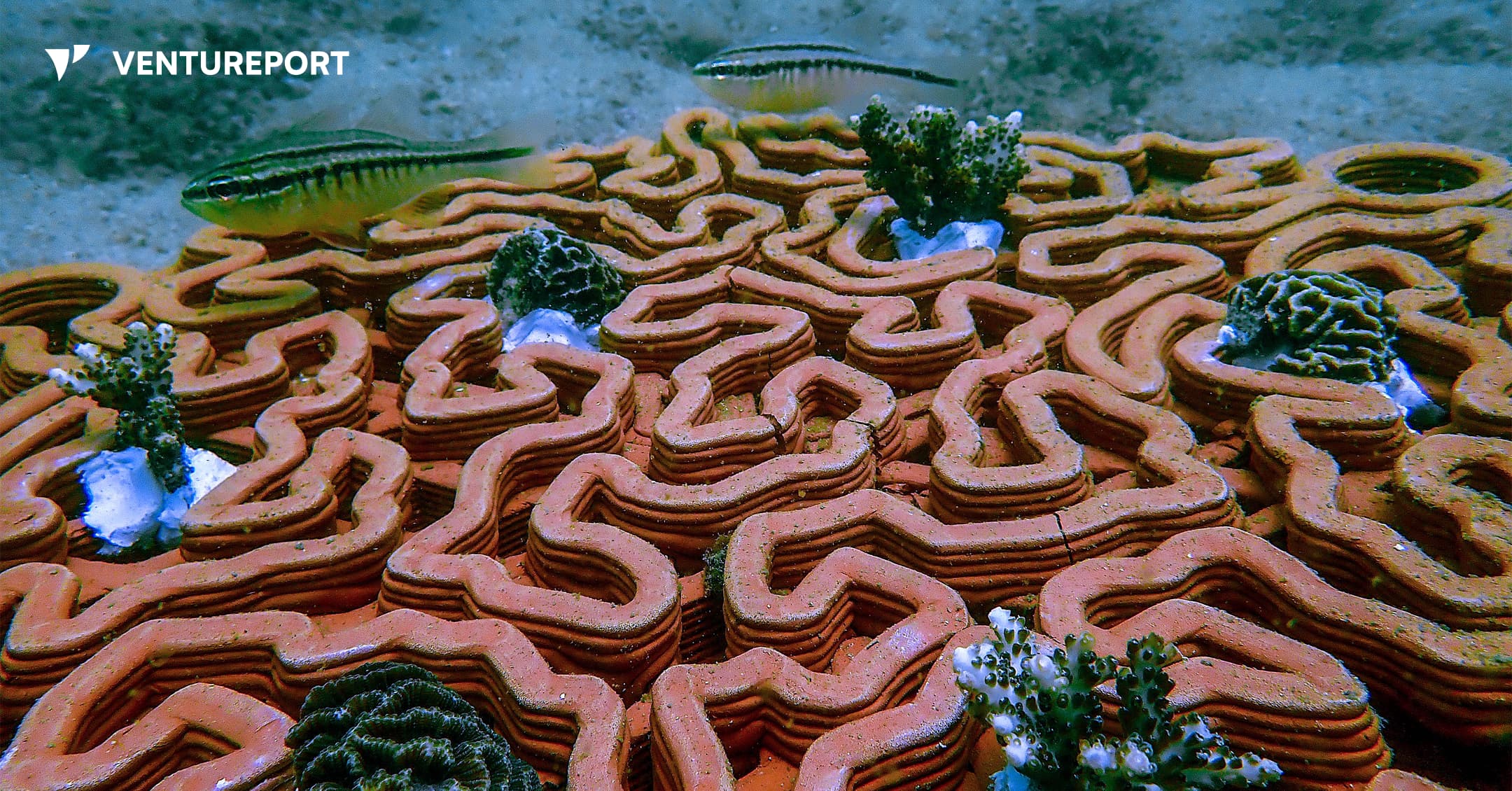
Young corals growing on Archireef's 3D-printed terracotta reef tiles beneath the sea. IMAGE: ARCHIREFF
Anyone who has snorkeled over a coral reef has probably admired its vibrant colours and the marine life swimming between its branches. What is less visible is how easily these ecosystems can be damaged. Rising ocean temperatures and pollution continue to put reefs under pressure, while coastal development creates another threat. Construction can stir up sediment that settles on corals, blocking the sunlight they need and making it harder for damaged reefs to recover.
Protecting marine ecosystems is becoming a shared responsibility. Alongside scientists, governments and conservation groups, businesses whose operations affect the ocean are increasingly expected to understand, manage and reduce their environmental impact. They must also show regulators, banks and investors that they are meeting their environmental commitments.
Archireef helps businesses meet those demands. Founded by Vriko Yu, the Hong Kong-rooted B2B startup specializes in marine ecosystem restoration and ocean nature risk management. Drawing on years of research at the University of Hong Kong, Yu built the company to help organisations understand, measure and reduce their impact on marine ecosystems.
Yu describes Archireef as an “end-to-end ocean nature risk management company”.
“What we offer them is a credible way to meet those obligations and stand behind the results,” she says.
One of the company’s main tools for restoring damaged marine ecosystems is its flagship 3D-printed terracotta reef tile. The tiles provide a stable foundation where young corals can attach, grow and survive over time.
Archireef chose terracotta instead of concrete and other conventional materials because it is pH-neutral and does not release harmful chemicals into the water. Its surface also gives corals a suitable place to attach naturally.
Before placing a single tile in the ocean, the team studies the proposed restoration site to determine whether recovery is possible. It assesses the water quality, biodiversity and general health of the ecosystem. As Yu explains, restoration should begin only where nature has a realistic chance to recover.
“Restoration isn’t about replacing nature or engineering a reef into existence. It is about removing the barriers and giving a degraded system the conditions it needs to begin recovering on its own”, she says.
Once the team selects a site, divers carefully place the tiles on the seabed. Their curves, ridges and crevices imitate the structure of a natural coral reef, creating sheltered spaces for marine species. The design also helps limit sediment build-up, which can block sunlight and smother young corals.
.webp)
Archireef adjusts the shape of its reef tiles for each project.
“There’s no universal reef, so there’s no universal tile”, Yu says.
Instead of producing one standard model, the company adapts each design to the coral species, water conditions and surrounding marine environment. A coral restoration project in Hong Kong may therefore require a different tile from one in Saudi Arabia, even when the same manufacturing process is used.
“The biggest adaptation from site to site is usually the match between design, species and environment, not the manufacturing itself ”, Yu explains.
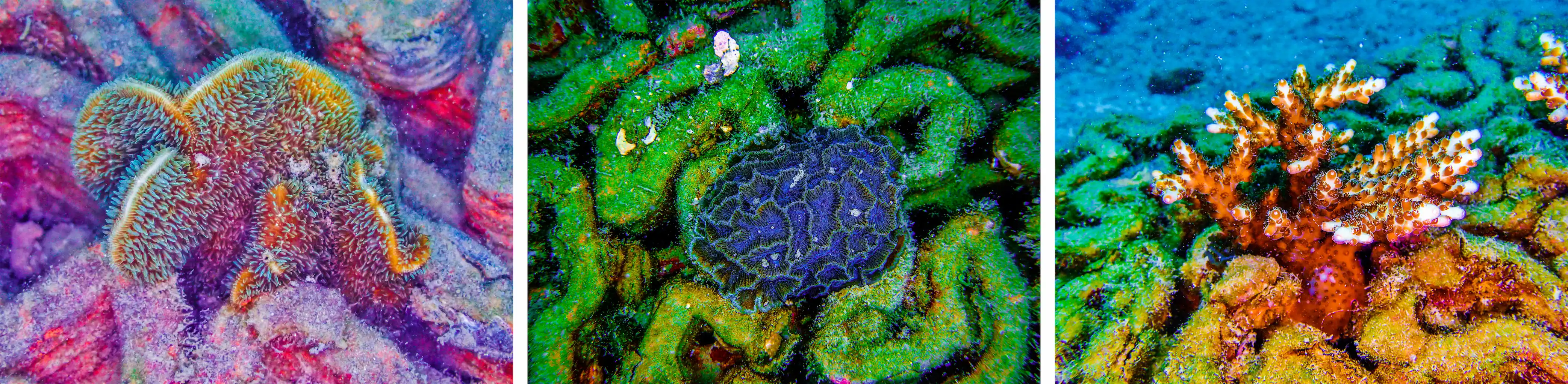
Although the reef tile is Archireef’s most recognizable innovation, Yu sees it as one part of a much broader service.
“The reef tile gets the attention because it’s tangible,” she says. “But the real product is the proof — defensible, audit-ready evidence of nature recovery that an organization can put in a disclosure and stand behind under scrutiny”.
Producing that evidence requires years of biodiversity monitoring. Long after the reef tiles have been installed, Archireef continues to track coral survival and the health of the surrounding marine ecosystem. Its monitoring methods include ecological surveys, AI-assisted species recognition, photogrammetry and environmental DNA testing.
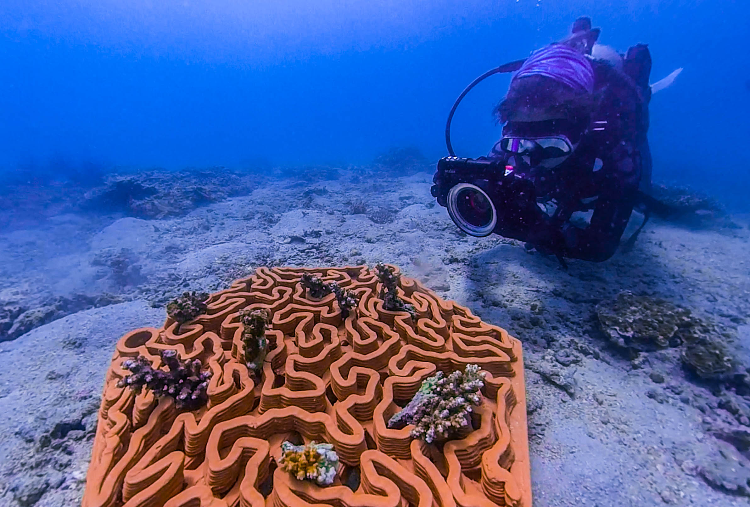
Photogrammetry uses photographs to produce detailed 3D models of the reef. These models allow the team to measure changes in coral growth and reef structure over time.
Environmental DNA, commonly known as eDNA, offers another way to monitor marine biodiversity. Traditional ecological surveys often depend on divers recording the species they can see. eDNA testing instead examines traces of genetic material left in the water by marine organisms, including skin cells, mucus and waste.
By analyzing these traces, Archireef can detect species that may be hidden, difficult to identify or absent during a dive. This gives the company a more complete picture of the ecosystem and how it is changing.
For Archireef, the success of a coral reef restoration project is determined by what happens several years after installation.
“The indicators that matter aren’t the ones that look good on deployment day”, Yu says. “They’re the ones that show, two, three and five years on, whether a genuine ecosystem is establishing and sustaining itself”.
At the company’s first restoration site in Hoi Ha Wan, Hong Kong, around 90% of the transplanted corals remained alive four years after deployment. The long-term survival rate suggests that the ecosystem is recovering rather than simply appearing healthy during the early stages of the project.
Results like these have helped Archireef move beyond academic research and secure collaborations across the public and private sectors. In Hong Kong, the company has worked with government departments and public organisations responsible for coastal infrastructure and marine conservation.
Keep Reading
What Overstory’s vegetation intelligence reveals about wildfire and outage risk.
Updated
January 15, 2026 8:03 PM

Aerial photograph of a green field. PHOTO: UNSPLASH
Managing vegetation around power lines has long been one of the biggest operational challenges for utilities. A single tree growing too close to electrical infrastructure can trigger outages or, in the worst cases, spark fires. With vast service territories, shifting weather patterns and limited visibility into changing landscape conditions, utilities often rely on inspections and broad wildfire-risk maps that provide only partial insight into where the most serious threats actually are.
Overstory, a company specializing in AI-powered vegetation intelligence, addresses this visibility gap with a platform that uses high-resolution satellite imagery and machine-learning models to interpret vegetation conditions in detail.Instead of assessing risk by region, terrain type or outdated maps, the system evaluates conditions tree by tree. This helps utilities identify precisely where hazards exist and which areas demand immediate intervention—critical in regions where small variations in vegetation density, fuel type or moisture levels can influence how quickly a spark might spread.
At the core of this technology is Overstory’s proprietary Fuel Detection Model, designed to identify vegetation most likely to ignite or accelerate wildfire spread. Unlike broad, publicly available fire-risk maps, the model analyzes the specific fuel conditions surrounding electrical infrastructure. By pinpointing exact locations where certain fuel types or densities create elevated risk, utilities can plan targeted wildfire-mitigation work rather than relying on sweeping, resource-heavy maintenance cycles.
This data-driven approach is reshaping how utilities structure vegetation-management programs. Having visibility into where risks are concentrated—and which trees or areas pose the highest threat—allows teams to prioritize work based on measurable evidence. For many utilities, this shift supports more efficient crew deployment, reduces unnecessary trims and builds clearer justification for preventive action. It also offers a path to strengthening grid reliability without expanding operational budgets.
Overstory’s recent US$43 million Series B funding round, led by Blume Equity with support from Energy Impact Partners and existing investors, reflects growing interest in AI tools that translate environmental data into actionable wildfire-prevention intelligence. The investment will support further development of Overstory’s risk models and help expand access to its vegetation-intelligence platform.
Yet the company’s focus remains consistent: giving utilities sharper, real-time visibility into the landscapes they manage. By converting satellite observations into clear and actionable insights, Overstory’s AI system provides a more informed foundation for decisions that impact grid safety and community resilience. In an environment where a single missed hazard can have far-reaching consequences, early and precise detection has become an essential tool for preventing wildfires before they start.